Volcanoes National Park Hikes – A Guide to Hitting the Trails Near Volcano Village
A Hiker’s Dream Destination – Diverse Terrain, Active Volcanoes, and World-Class Trails
At over 500 square miles in size, with trails of all lengths and difficulties, Volcanoes National Park hikes are unlike anywhere else in the world – on one outing, you can explore a rainforest, traverse a hardened lava field, observe rare plants only found on the Big Island, and witness volcanic activity up close. Start with the area near the crater of Kilauea – easily accessible via the Crater Rim Drive – and get acclimated with the park’s geography, then venture off on some of the less-crowded and more adventurous trails spread throughout the park.
Bring your hiking shoes, pack layers for the always-shifting weather patterns, and plan your Big Island hiking itinerary. These hikes have tropical and volcanic scenery that will take your breath away, with stunning views around every turn, all just a few miles from our Volcano bed and breakfast.
Kilauea – A Volcanic Wonder, With Trails Abound
There’s no better place to start your hiking exploration of the park than at the summit area of Kilauea – the world’s most active volcano – which has had lava activity more or less continuously since 1983, with some brief periods of calm. Before and during your trip, check for updates on the status of Kilauea, including seismic activity that can be a sign of the increased likelihood of lava flowing again soon.
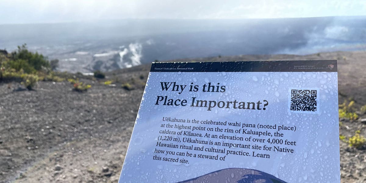
After paying the vehicle fee at the entrance station, stop by the Visitor Center to get current trail conditions from park rangers, then cruise the 11-mile Crater Rim Drive. Stop for an easy 1.5-mile hike around the steam vents and sulfur banks, where you’ll see steaming-hot water vapor emitting from over 80 fissures in the newly-formed lavascape (90% of the surface of Kilauea is less than 1,100 years old!). The Crater Rim Trail is easily accessible from this same area, with incredible views of Kilauea’s massive 2,600-acre-wide caldera.
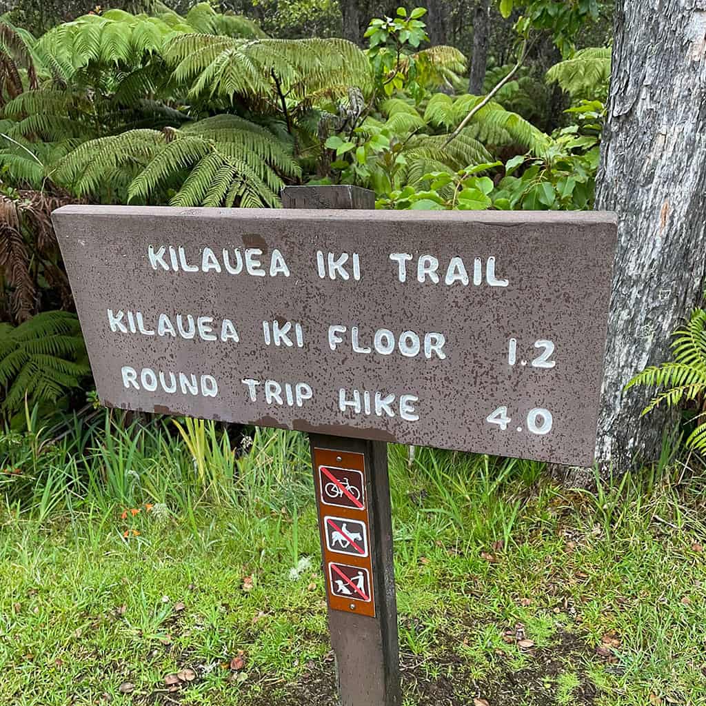
On the other side of Kilauea’s crater, you’ll find two of our favorite places in the park – Kilauea Iki Trail and the Nahuku Thurston Lava Tube. Kilauea Iki Trail features every aspect of the island’s unique topography, all in one hike, from a lush forest with rare ferns and birds to a lava field with steam still coming up through the cracks in its surface. See our sister property’s recent Kilauea Iki Trail blog for more detailed info about the iconic route. And the Thurston Lava Tube (just a half-mile from Kilauea Iki) is not to be missed, as the hollowed-out walkable cave formed by 2,000-degree lava is unlike anywhere else in the park. The lava tube is a short hike, and Kilauea Iki can be shortened according to what your group can handle, so both are great for kids.
The Heights of Mauna Loa, Desert Footprints, and Other Can’t-Miss Trails
With its often-active lava lake and essential role in Hawaiian folklore (the goddess of volcanoes, Pele, is said to reside in Halema’uma’u crater), Kilauea commands both attention and respect. But be sure to explore other zones in the park, each with unique trails and landscapes.
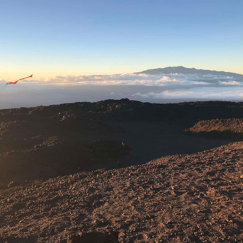
Mauna Loa – the sister volcano to Kilauea, less than 25 miles away, and active as recently as late 2022 – is staggering in its size, making up half of the Big Island’s landmass. The Mauna Loa Trail is a steady climb up its flank, with the entire hike at 12.8 miles roundtrip. It’s very challenging but worth the effort, as you’ll get some of the best views on the island from its 13,000-plus-feet summit. And you’ll see rare plants like the Mauna Loa Silversword, which have striking silver leaves and are endemic to Hawaii, only found at high altitudes on the islands.
One of the best aspects of the park is that a cloudy and rainy day at the Kilauea summit (not uncommon, as the Hilo/Volcano side of the Big Island gets plentiful rainfall) can be an afternoon of brilliant sunshine in another region. A perfect example is the Ka’u Desert Trail, an easy 1.75-mile roundtrip hike on the other side of the Kilauea ridgeline. Because it’s situated in the rain shadow of Mauna Loa, it receives far less rain than the rest of the park, especially compared to the Volcano Village side, which gets 120 inches of rain annually. Look out for the fossilized footprints along the desert trail, a mesmerizing glimpse at human history preserved in the lava plateau.
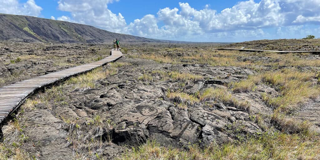
Be sure to also explore the region alongside Chain of Craters Road, which descends 4,000 feet from the summit of Kilauea down to the coastline (including the majestic black sand beach at Isaac Hale Beach Park). The Pu’u Loa Petroglyph Trail is one of the park’s most sacred sites, where 23,000 pieces of rock art are preserved in the lava fields. It’s only 1.4 miles roundtrip along a wooden boardwalk, so it’s doable for all ages and is an unforgettable hiking experience. The Naulu Trail is also nearby and crosses lava fields, with fascinating sights like collapsed lava bubbles and mini lava tubes. And at the end, you’ll be rewarded with some of the best views of the Pu’u’o’o Cone, the site of much of Kilauea’s eruptions over the past three decades and where a staggering 14 miles of new lava has flowed.
Stay with us and tie up your hiking boots, as these Volcanoes National Park hikes will be just steps away from our Big Island bed and breakfast!